
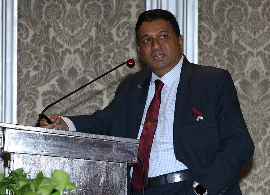
Cmde (Dr.) Srikant B. Kesnur on the Strategic Significance of the Nicobar Port Project
Good afternoon, ladies and gentlemen.
First, it is a great honour and privilege for me to be invited to the most premier Rotary Club in the country. I understand that this is a Club with several distinguished members, so it is a real pleasure to be here. Thank you so much, distinguished office-bearers.
I have had a bit of an association with Rotary, in the sense that over the last few years, I have spoken at various Rotary forums. It has always been a happy experience for me to come back to another Rotary Club. Two years ago, much to my pleasant surprise, I was awarded the Rotary Community Care Award, sponsored by the Rotary Club of Marine Lines and, apparently, decided by all the Rotary Clubs in Mumbai and Greater Mumbai. More importantly, they awarded it to me for my efforts in maritime education, which I thought was wonderful because it is such a niche area.
I must also go back to my childhood in a small town in northern Karnataka, where the Rotary District 317 in Bijapur and Rotaract encouraged young people who would write and speak. So, thank you ever so much.
Let me begin with a small piece of trivia that, in a rather unusual way, connects the Nicobar Islands to the Taj, where we are all sitting today.
After the surrender of the Japanese in 1945, the Navy’s flagship, INS Narbada — named after the River Narmada but spelt Narbada in those days — brought back the huge binoculars that the Japanese had installed at various locations in Port Blair. They were mounted on the ship and placed on the quarterdeck. Whenever Narbada was anchored here, there was very little naval infrastructure ashore, so sailors would use those giant binoculars from the ship’s quarterdeck to watch the proceedings in the ballroom of the Taj. That is one little story that connects this wonderful place with the Nicobar Islands.
Let me now begin what I call my opening salvo. I shall try to get through the first part fairly quickly.
I would like to begin with a couple of caveats. First, what I am presenting is my point of view, not that of the Government of India, and certainly not that of the Indian Navy. Second, I do have a firm point of view. I shall try to be as objective as possible and acknowledge other perspectives. We can certainly discuss them later. My purpose is to present my convictions while remaining objective.
Andaman and Nicobar Islands have immense historical importance, which we shall touch upon, but they also possess a unique geography with a distinctly maritime orientation. They are located close to vital Sea Lines of Communication, or SLOCs, and provide access to a major maritime choke point. Out of 836 islands, only 31 are inhabited.
The islands also have a huge Exclusive Economic Zone, or EEZ. Although the land area is only around 8,000 square kilometres, the EEZ constitutes nearly one-third of India’s total EEZ. I shall illustrate this visually shortly. An Exclusive Economic Zone is, in many ways, almost like a country’s sovereign territory in terms of economic rights. These islands overlook one of the world’s most important maritime channels through which a significant proportion of global trade passes.
All of you in Mumbai are familiar with the importance of real estate. If I may say so, this is among the most valuable real estate on the globe. The question, however, is whether we have sufficiently recognised its strategic significance.
We are living in a highly volatile world where almost everything is being weaponised. India is a rising power, and I am sure you will agree that the Indian Navy is playing an increasingly important role. However, I have placed a question mark over some of these issues because I believe they deserve debate. In my opinion, some of our recent initiatives concerning the Andaman and Nicobar Islands represent a positive trend, but if you disagree, that is perfectly acceptable.
Let us take a quick historical overview.
There is an ancient history that associates the name ‘Andaman’ with Hanuman, although whether that connection belongs to mythology or historical fact is a separate debate. There is, however, definite evidence that the Cholas used the Nicobar Islands, then known as Nakkavaram, as a watering station during their overseas expeditions.
Moving to more recent history, before the Second World War and before Independence, these islands served as a British penal settlement, something all of you are familiar with. The Japanese occupied them in 1942 and withdrew in 1945. They are also closely associated with Netaji Subhas Chandra Bose, the Indian National Army and Veer Savarkar. In addition, they played a significant strategic role during the Second World War.
The post-1947 history is equally interesting. I hope you are aware that during the 1965 war, Indonesia briefly laid claim to the Andaman and Nicobar Islands. They suggested that the islands belonged to them and even deployed submarines and ships in support of Pakistan during that conflict. Please remember that today India enjoys excellent relations with Indonesia.
During the 1971 war, the Indian Navy’s Eastern Fleet assembled off the Andaman Islands in Cornwallis Bay while preparing operations against East Pakistan. Why am I telling you this? Imagine, for a moment, if the Andaman and Nicobar Islands had belonged to Indonesia, Pakistan, or even Britain. Would India have enjoyed the same strategic depth and operational freedom for both economic and military purposes?
This raises an important question. Did geography shape our strategic outlook?
When Chinese President Hu Jintao spoke about the ‘Malacca Dilemma’ around 2002 or 2003, did we stop to ask why he considered it such an important issue and how India could leverage that reality?
History gives us lessons. Geography gives us location. But leveraging that location depends entirely upon the people. As K. M. Panikkar, one of India’s foremost strategic thinkers, observed, the future of India’s history has been determined not on its land frontiers but by the seas that wash its shores.
Interestingly, even Panikkar spoke only of the seas washing three sides of India; he did not include the islands in that otherwise remarkable observation. That is why I believe we should seriously consider Defence Minister Rajnath Singh’s more recent statement that “India is an island nation with land borders.”
That is how we must begin thinking. We are literally sitting by the sea, and we must consciously develop a maritime mindset.
How did the British view the islands? In fact, the initial clauses relating to Indian Independence did not envisage transferring Lakshadweep, Minicoy, or the Andaman and Nicobar Islands to India. It was only after considerable discussion that Lord Mountbatten reportedly remarked that his reputation would suffer if that happened. Historical records suggest that the India Office and the Chiefs of Staff were exerting considerable pressure on him.
Why were they doing so?
Because, even in the 1940s, Britain viewed these islands as vital links in its air and communication routes to Australia and New Zealand. In other words, they were already thinking in Indo-Pacific terms in 1945.
Pakistan, too, recognised their importance. Muhammad Ali Jinnah argued that Pakistan required the Andaman and Nicobar Islands to connect the eastern and western parts of the country. Of course, the argument was unrealistic, but the point is that he recognised their strategic significance.
Now imagine once again if these islands had remained under British, Pakistani, or Indonesian control after Independence. Would India have been able to conduct the operations it did in 1971?
We need to reflect upon that.
I have deliberately not reproduced one particular quotation because I am uncertain about the context in which it was made. However, India’s Home Secretary reportedly remarked that India did not consider the Andaman and Nicobar Islands especially important. At best, he suggested they might eventually host a naval or military base, or perhaps simply a meteorological station. I do not know whether that statement was intended to lower political tensions, so I prefer not to quote it directly. Nevertheless, it illustrates the thinking of that period.
This photograph shows Dr. Rajendra Prasad visiting the islands in 1954, seven years after Independence. It was the first visit by a senior Indian political leader.
I often describe it as the meeting of two worlds. Dr. Rajendra Prasad is seated on the forecastle of the ship, spinning the charkha, while two Indian Navy officers stand nearby, perhaps wondering what exactly was happening. I use this image because it symbolises the meeting of two different philosophies. India achieved Independence through a non-violent movement, whereas the armed forces represent the state’s legitimate use of force. So, was there a gap in our strategic thinking? That is a question I leave before you.
In 1981, Admiral M. K. Roy met Prime Minister Indira Gandhi in the Andaman and Nicobar Islands and showed her a fascinating map. It simply depicted India upside down to demonstrate how dependent the country really is on the seas. Normally, when we look at a map, Delhi occupies the central position and our thinking becomes land-centric. But the Earth is round. Looking at India from a maritime perspective provides a much better understanding of our strategic realities.
Admiral Roy explained to Mrs. Gandhi just how dependent India is upon the seas.
India’s EEZ today extends to roughly two million square kilometres — about two-thirds the size of our landmass — and could eventually increase to nearly three million square kilometres if some of our claims before the United Nations are accepted. In effect, India’s maritime domain could become almost as large as its land territory.
The important question, therefore, is whether we have adequately thought about how to utilise this vast maritime space.
The next slide summarises discussions from several editions of the Dweep Rakshak Dialogue, a series of strategic discussions in which I participated over two or three years in the Andaman and Nicobar Islands.
From a military perspective, our development of the Andaman and Nicobar Command has been relatively slow. The Navy, Army, Air Force, and Coast Guard gradually established their presence, and the first tri-service command came into being only in 1984. We were responding to the post-Cold War strategic environment, and initiatives such as the MILAN series of multilateral naval engagements were introduced to strengthen diplomatic and strategic cooperation with countries across the region.
After Kargil, we established the Andaman and Nicobar Command. Essentially, over the last 20 to 30 years, people have been asking how we can bring about a change in mindset. Our approach to the Andaman and Nicobar Islands has always been defensive — we must guard them — instead of viewing them as a pivot or a springboard for engaging with the East.
Many people describe islands as “unsinkable aircraft carriers”. As an aircraft carrier fundamentalist, I believe that is the wrong expression because it assumes that aircraft carriers at sea sink all the time, which is obviously incorrect. Islands are, in fact, natural aircraft carriers. They provide strategic reach and extension, and the Andaman and Nicobar Islands act as India’s great eastern flank.
The question is whether we have learnt from history. We must not repeat the mistakes we made in the Northeast and the Himalayas. While China built extensive infrastructure along the border, we kept delaying development because of various concerns. Then, when incidents such as Galwan occurred, it took us considerable time and effort to mobilise, whereas they already had airfields and infrastructure just across the border.
One of the key lessons is that we should not repeat that mistake. We need a whole-of-government approach that combines commerce, logistics, and security, because that is how future development must take place. At the same time, we must ensure sustainable development and respect for the environment. When considering development in island territories, issues of power, security, statecraft, and political economy all come together. That is what makes such projects both important and challenging.
This is an important data point, ladies and gentlemen. India has recently become the world’s second-largest seafaring community, overtaking China and ranking only behind the Philippines. We now have more than 315,000 Indian seafarers serving on merchant ships. That number has tripled over the last 15 years.
However, less than 5 per cent of our trade is carried on Indian-flagged vessels. This means that the overwhelming majority of our seafarers are employed on foreign-flagged ships. We therefore have a highly skewed maritime balance sheet.
Our Navy is among the five or six most powerful in the world. We are one of the few countries capable of building aircraft carriers and nuclear submarines. Yet our share of global commercial shipbuilding is less than 2 per cent, whereas China accounts for around 40 to 50 per cent of the world’s shipbuilding.
Forty years ago, around 40 per cent of India’s trade was carried on Indian-flagged vessels. Today, that figure has fallen to less than 5 per cent, even though our commercial shipping capacity has grown by about 3 per cent every year. The reason is simple: our trade has expanded at a much faster pace. All of us represent a more prosperous India — an India that consumes more, trades more, and aspires to more. That is the hallmark of a prosperous maritime nation.
However, if we continue to maintain such an imbalanced maritime balance sheet, someone will eventually exploit it, as we have seen during the recent crisis in West Asia. That is why I have often remarked that people who barely knew where Mahim Creek was are now discussing the Strait of Hormuz.
At a time when there are only about half a dozen Chinese naval vessels operating in the Indian Ocean Region, there are more than 40 or 50 navies from around the world present there. That is the broader strategic context behind the Great Nicobar Project.
This map shows how the project straddles the Six Degree Channel. The Ten Degree Channel may become equally important if the proposed Kra Isthmus project in Thailand eventually materialises, but today the Six Degree Channel is one of the busiest maritime routes in the world.
As I said earlier, some of the most valuable real estate in the Indian Ocean is occupied by the Andaman and Nicobar Islands. Almost every major sea lane — or, more accurately, every major Sea Line of Communication — passes close to these islands.
The traffic coming through the Suez Canal and heading east towards the Malacca Strait and the Pacific passes this way. Traffic from the Gulf through the Strait of Hormuz also passes this route. Ships sailing around the Cape of Good Hope towards East Asia follow the same corridor, as do vessels travelling westbound. Virtually all major east-west maritime traffic passes close to the Andaman and Nicobar Islands.
We have all become much more aware of choke points in recent years. Four years ago, when a single ship became stranded in the Suez Canal, this was what global shipping traffic looked like. Every dot on the map represented a ship. A single obstruction forced vessels to make lengthy detours around Africa.
Choke points are not disrupted only by physical blockages. Today, the Houthi attacks on merchant shipping in the Red Sea are forcing many shipping companies to bypass the Suez Canal altogether and sail around Africa. In other words, choking can occur through a variety of means, including military pressure or persistent threats to commercial shipping.
We often discuss the Strait of Hormuz, but notice how much busier the Malacca Strait actually is. Around 30 per cent of global trade passes through the Malacca Strait, with approximately 100,000 ships transiting it every year. The moment those ships emerge from the narrow Malacca funnel, the first major strategic location they encounter is the Nicobar Islands.
That brings me to the Great Nicobar Project itself.
The project comprises four major components, the most important of which is an international container trans-shipment terminal. It is envisaged as a major investment and development project. The port’s planned capacity is expected to increase from around 4 million TEUs to 14.2 million TEUs. The overall project cost is estimated at approximately ₹81,000 crore and is intended to be implemented under a public-private partnership model, with 55 per cent equity coming from private investors.
What is its economic significance?
Simply put, around 75 per cent of India’s container cargo is currently trans-shipped through foreign ports before reaching India. In other words, goods imported into India — from footwear to industrial equipment — often first arrive at ports such as Colombo, Singapore or, in some cases, Port Klang, before being transferred onto another vessel for shipment to India. The majority of this trans-shipment currently takes place through Colombo.
With no disrespect to that wonderful country, one must ask why India itself should not possess a port capable of handling this traffic directly. We simply have not had such a facility.
The direct annual revenue loss from container handling, pilotage, and related port services is estimated at around US$200 million. The indirect economic loss — including ship chandling, marine services and other associated commercial activity — is estimated to be approximately US$1 billion every year.
This is a classic example of the wider economic ecosystem that develops around maritime activity. That is why people often say that navies build bridges, while armies build walls. Wherever maritime trade flourishes, restaurants emerge, service industries develop, marine suppliers establish businesses, and entire local economies grow. All of this demonstrates why India needs to think much more like a maritime nation.
Interestingly, that estimated indirect annual loss of US$1 billion is roughly equivalent to the cost of the entire Great Nicobar Project.
The proposed Nicobar port also enjoys significant natural advantages. It has a natural draft of more than 20 metres, allowing it to accommodate most of the world’s largest commercial vessels. Combined with its strategic location, it gives India something even more valuable — a major trans-shipment hub located on sovereign Indian territory.
Most importantly, if another country were sending critical or high-value cargo to India, it could come directly to an Indian port instead of depending upon foreign trans-shipment hubs.
If critical cargo destined for India has to be trans-shipped through Sri Lanka, Singapore or elsewhere, external powers such as China or even the United States could potentially bring pressure to bear and say, “Do not send that cargo to India.” That is the importance of having your own trans-shipment port above everything else. It is sovereign Indian territory, and it also strengthens initiatives such as Make in India.
What, then, is the strategic significance?
Many people misunderstand the nature of India’s presence there. It is not intended to be a literal equivalent of what Iran seeks to achieve at the Strait of Hormuz. Rather, the value lies in being close enough to an important maritime choke point to monitor developments, maintain a presence, and exercise influence when necessary. India has no intention of blocking the Malacca Strait. We should not even contemplate that unless we are at war. However, our presence there would compel any potential adversary to think twice before sending naval forces or commercial traffic through the Malacca Strait.
As I mentioned earlier, we are also developing the port at Sabang in cooperation with Indonesia, on the western side of the Malacca Strait. Together, these initiatives will, I believe, help counter growing Chinese influence and strengthen India’s Indo-Pacific strategy.
Remember the two terms SAGAR and MAHASAGAR. SAGAR was a remarkable articulation by the Prime Minister in Mauritius in 2015 — Security and Growth for All in the Region. This is not merely a slogan. The moment you speak of both security and growth together, you move beyond the old debate of guns versus bread or guns versus butter. Instead, you recognise that security and prosperity go hand in hand. I might even go so far as to say, “guns for butter.”
Equally significant is the phrase “for all”. There are no exclusions, unlike the tendency in some parts of the world to divide countries into “those with us” and “those against us”. The concept later evolved into MAHASAGAR — Mutual and Holistic Advancement for Security and Growth Across Regions. It provides a coherent strategic vision around which India can develop its policies.
I fully acknowledge that there are many valid concerns about the Great Nicobar Project. They deserve consideration. The principal issues raised relate to ecology and biodiversity conservation, the safety of tribal communities, seismic and tsunami vulnerability, economic viability, allegations of crony capitalism, and the broader debate around sustainable development. In my humble opinion, each of these deserves to be examined carefully.
Let me begin with the tribal population.
Yes, every tribal community is important, and we certainly do not want any of them to disappear. The two principal tribal groups concerned are the Nicobarese and the Shompens. The Shompen population numbers fewer than 300 people — around 227 — and they live deep within the forests. The area proposed for development does not lie within the Shompen habitat.
One concern often raised is that the Shompens occasionally travel towards Galathea Bay for hunting and may therefore come into contact with an expanded human population. In my opinion, that argument stretches the issue too far. Despite the infrastructure already developed across the islands, the populations of the tribal communities in the Andaman and Nicobar Islands have generally declined over the past few decades, even though they have largely been left undisturbed.
Among these communities, the Nicobarese population has remained relatively stable at just over 1,000. The Nicobarese already have some interaction with the outside world, and it is possible that carefully managed engagement by the Government could actually contribute to their long-term welfare. In any case, the Particularly Vulnerable Tribal Group, namely the Shompens, live well away from the proposed development area. Even the designated core and buffer zones are located away from Galathea Bay.
The next concern relates to seismic vulnerability.
Yes, Great Nicobar falls within Seismic Zone V, the highest risk category. However, these classifications have been established by the Government of India and include many parts of mainland India, including Uttarakhand, Himachal Pradesh, and parts of Bihar. Have we stopped constructing infrastructure in those regions?
Since the 2004 tsunami, at least 15 to 20 countries have experienced earthquakes or tsunamis. Have they stopped building altogether? Surely the answer is not to abandon development but to build resilient infrastructure that takes these risks into account. Ultimately, that is a decision the nation must make.
What about economic viability?
The project has been conceived as a public-private partnership. When the Government of India invited Expressions of Interest, fourteen consortia responded, including four international participants. Investors commit their capital only when they believe a project has long-term potential.
There is also the criticism that the project represents crony capitalism. I do not wish to make this a political issue, but I find that argument rather curious. I have no financial interest whatsoever in companies such as the Adani Group, the Tata Group, the Birla Group, or any other corporate house. However, I would much rather see Indian companies building our infrastructure than importing everything from foreign private corporations.
Why should we buy a Rafale aircraft manufactured by a foreign private company while objecting to Indian private companies building ports, bridges, aircraft, or dams? Of course, every project must undergo proper due diligence and scrutiny. But we should also take pride in the capability of Indian private enterprise to deliver major national infrastructure.
Then comes the debate on sustainable development.
As I mentioned earlier, there are many dimensions to this discussion. We can certainly improve aspects of the project where necessary. However, I found one aspect of the debate particularly interesting. Those supporting the project consistently acknowledged the need to address environmental concerns. Yet very few of those opposing the project on environmental grounds acknowledged the equally important strategic concerns. In that sense, the debate itself has become somewhat unbalanced.
To illustrate the process, consider the number of organisations involved in the Environmental Impact Assessment. Some have argued that the assessment was undertaken by a private agency. However, numerous highly respected technical institutions, non-governmental organisations, and Government bodies participated in the process.
The clearance from the National Green Tribunal took nearly two years. The project is subject to forty-two separate compliance conditions.
There has been considerable discussion about the leatherback turtle. One of the mandatory environmental conditions is that the leatherback turtle nesting site on the western side of the island must remain completely undisturbed. It is one of only thirty-three such nesting sites.
The total development footprint at Galathea Bay, including the proposed township, occupies only about one-sixth of the island’s land area. The overall forest cover of the Andaman and Nicobar Islands currently stands at approximately 94 per cent. Following the project, that figure would reduce by only about 1.8 percentage points, leaving forest cover at around 92.2 per cent. By comparison, the global average forest cover in many countries is around 50 per cent.
The environmental safeguards are substantial. Approximately ₹6,000 crore has been earmarked specifically for environmental protection. This includes funding for scientists, ecologists, monitoring teams, research facilities, and accommodation for the professionals who will oversee environmental compliance.
Twenty per cent of the leatherback turtles are to be geo-tagged and continuously monitored. Anyone familiar with wildlife conservation will appreciate how challenging it is to geo-tag sea turtles and track their movements over vast ocean distances. It is very easy to make suggestions from the comfort of a drawing room.
For perspective, Singapore covers about 750 square kilometres and has a population of approximately six million people. Great Nicobar covers roughly 1,000 square kilometres but has a population of only around 10,000. If the argument is that no development whatsoever should take place, then, in my view, that is a rather myopic position.
Ultimately, ladies and gentlemen, we have to make a choice. There can be no ecological security without overall national security. At the same time, every aspect of the project deserves careful debate.
Statecraft inevitably involves taking calculated risks. No one here is clairvoyant. We may succeed, or we may fail. The advantage is that this project is phased over several decades, extending towards 2047 and beyond. That provides ample opportunity to review progress at every stage, assess whether the intended outcomes are being achieved, and make corrections if the environmental or strategic consequences prove different from what was anticipated.
Please remember that we live in extraordinarily volatile times. Everything has become transactional. Recent global events have demonstrated that. As someone observed, if everything becomes a weapon, then everyone becomes a potential victim. Future conflicts will not necessarily resemble traditional wars. Trade, shipping, cargo, oil, energy, and supply chains are all becoming instruments of strategic competition.
I believe India has, until now, adopted an approach that has been cautious — perhaps even excessively cautious. Faujis are naturally pessimistic, and that often results in what I would describe as strategic paralysis. Today, however, we face an uncompromisable strategic imperative.
As one observer aptly remarked, the Andaman and Nicobar Islands form the bridge between the Indian and Pacific Oceans. They are the strategic nerve centre of the Indo-Pacific.
I believe the time is now. As Prime Minister Narendra Modi has often said, “Yahi samay hai, sahi samay hai.”
Let me conclude with one of my favourite statements:
“Samudra Bharat hee Samruddha Bharat hai.”
On that note, ladies and gentlemen, let me leave you with the words of one of our Chiefs, who said in 1968 that India should act as a moderating influence in the region — and we can do so only if we possess the power to make that influence meaningful.
Thank you very much for your patient hearing. I would be delighted to take your questions, including any darts you may wish to throw.
Thank you.
Question 1: Yes, sir. Why don’t we have a plebiscite? There is so much debate over this project. If the local people want it, then let them decide. We also know how compromised many monitoring agencies can become.
Secondly, with regard to Galwan, when China has occupied some of our territory, should we not first focus on protecting Galwan before embarking on projects such as this?
Cmde (Dr.) Srikant B. Kesnur: On the question of a plebiscite, the first issue is: where, and with whom, would you conduct it? Would we hold a nationwide plebiscite on whether the Great Nicobar Project should proceed? If we adopt that approach, we will end up holding plebiscites on everything — from the education system to whether the education minister should continue in office.
We elect governments for a reason. The Executive has defined constitutional authority, and there are checks and balances within the system. If citizens disagree with a decision, they have the courts available to them.
Sir, you are a very respected person, and I would be happy to continue this discussion over a drink. However, we cannot become endlessly cynical about every institution of government. If we begin with the assumption that everyone in government is untrustworthy, there is no end to that cynicism.
Take the example of Admiral D. K. Joshi, the Lieutenant Governor of the Andaman and Nicobar Islands. He has probably spent more time there than almost anyone else. As a naval officer, he commanded the Andaman and Nicobar Command, he is an experienced diver who has personally explored the coral reefs, and he has repeatedly assured people about the safeguards being adopted. If we choose not to believe anyone at all, then meaningful discussion becomes impossible.
As for Galwan, I believe we must be careful in how we describe the situation. We have not lost territory. In fact, India’s response has compelled the Chinese to reassess their position because, for the first time, India mobilised along the border and responded in a manner they had not anticipated. The lessons from Galwan, Doklam and similar incidents are that, when India responds firmly and looks China in the eye, the Chinese, despite all their power, tend to step back. That is precisely the kind of strategic posture I am suggesting we adopt in relation to the Malacca Strait.
Question 2: Sorry, I just want to play devil’s advocate.
You mentioned that critics arguing this strategic development is really a cover for commercial interests. Without getting into whose commercial interests those might be, we already have a tri-service command in the Andaman and Nicobar Islands. Why, then, is further strategic development necessary?
Secondly, as you pointed out, the Government itself has classified the area as a high seismic zone. We have already built extensively in environmentally fragile regions such as Uttarakhand, and we have seen the damage that has resulted. There has been deforestation, the loss of natural barriers and biodiversity, and in the Andamans alone nearly a million trees are expected to be felled. Compensatory afforestation rarely succeeds in recreating the original ecosystem.
So, while your national security arguments are compelling, how do you reconcile them with the environmental damage that we have already witnessed in places such as Uttarakhand and other ecologically sensitive regions?
Cmde (Dr.) Srikant B. Kesnur: You have raised about half a dozen important points, so I will need a few minutes to answer them.
First, why not restrict development purely to military infrastructure?
Let us imagine that the Indian Navy were to say tomorrow that, for strategic reasons, it needed to take over the Taj Hotel because of its location. Clearly, that would be unacceptable.
On the other hand, suppose the Navy were to propose constructing a small jetty for its patrol craft near the Radio Club. That would be a different proposition altogether, and perhaps everyone could work together to make it happen.
The broader point is that no country in the world, including the United States, is willing today to invest enormous sums purely in military infrastructure. It is simply too expensive. Modern thinking increasingly focuses on dual-use or multi-use infrastructure, where commerce, logistics, trade and defence reinforce one another.
If you build an airport, it should be capable of accommodating both the largest civilian aircraft and the most advanced military aircraft. That way, it serves tourism, commerce and defence simultaneously. In fact, there is a strong argument that greater security is achieved when such locations become centres of trade and economic activity rather than isolated military cantonments. I am certainly not suggesting that naval establishments be opened to the public, but the larger principle is that a whole-of-government approach produces stronger security outcomes than relying solely on one agency.
The armed forces have sought additional funding for decades. It is difficult for any government to allocate unlimited resources exclusively for military purposes. However, if 55 per cent of a project’s funding comes through private investment, then commercial activity effectively subsidises strategic infrastructure that the military can also utilise.
As for commercial interests, it makes little difference to me which company eventually wins the contract. As of today, the project has not even been tendered. Any speculation about which company might receive it remains precisely that — speculation. What we do know is that there is considerable interest, and the bidding is open only to Indian companies. I sincerely hope capable Indian companies undertake the work.
Now let me address your final point regarding trees.
The number is not around 100,000. It is closer to 700,000 or 800,000 trees. However, that figure represents only one part of the overall picture.
Compensatory afforestation involving around 200,000 trees has already been undertaken elsewhere in the Andaman Islands, even before a single tree has been cut for this project. The proposed felling of approximately 700,000 trees, of which 10 to 20 per cent are already degraded, will occur gradually over a period of about twenty-five years. That provides ample opportunity to monitor the project’s impact and review its progress.
Although the plans have not yet been made public, I recently spoke to someone involved in monitoring the project. I was informed that more than 700,000 — and in fact close to 900,000 — trees are proposed to be planted elsewhere in the Andaman Islands, though not necessarily within Great Nicobar itself.
People often criticise compensatory afforestation by asking why replacement trees are planted elsewhere. The logic is straightforward. One does not plant additional trees in an already dense forest. Instead, afforestation is carried out in areas where forest cover is relatively sparse. That does not necessarily mean planting identical species, and I fully accept that habitat restoration is a far more complex scientific issue. Those are matters best decided by environmental experts.
Incidentally, the policy of compensatory afforestation is not new. It predates the present Government by many years. It is a standard environmental practice designed to increase forest cover where it is most needed.
I also agree that Uttarakhand and Himachal Pradesh offer valuable lessons. Those lessons should absolutely inform future planning. I am not suggesting that environmental concerns are irrelevant. On the contrary, they deserve careful consideration.
At the same time, should we not also place confidence in institutions such as the National Green Tribunal? Its members include recognised environmental experts. The Wildlife Institute of India, which is involved in monitoring the project, is not simply another Government department. It is a respected scientific institution.
Finally, consider a broader point. Virtually every major city and every significant infrastructure project has involved some degree of environmental alteration. Much of Mumbai itself stands on reclaimed land. Development anywhere — whether in Delhi, Mumbai or elsewhere — inevitably involves difficult trade-offs.
My view is that those trade-offs must be managed through rigorous safeguards. Precisely because this project has attracted such close public scrutiny, an unusually large number of safeguards have been built into it. The Government has allocated approximately ₹6,000 crore solely for ecological protection measures. That funding is intended for scientists, ecologists, monitoring programmes and environmental oversight — not for roads, buildings or other construction activities.
I appreciate the concern that landscaping or plantation cannot recreate an original ecosystem, and I accept that point. Nevertheless, if people remain unconvinced, the answer is to continue the dialogue and strengthen the safeguards. My own view, however, is that India should not abandon this project.