
RCB maps history: Asiatic Society Exhibition showcases rare cartographic treasures form India’s past
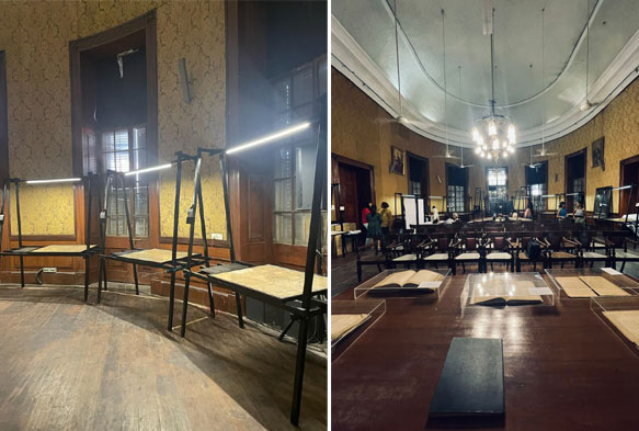
Back in 2019, the Urban Heritage Committee of the Rotary Club of Bombay extended their support to the Asiatic Society of Mumbai for a Cartographic Conservation Project, with an aim to conserve close to a 100 maps from the Library’s treasured rare map collection. This restoration effort has prompted the organisation of yet another exhibition titled “Mapped: Surveys that left behind a legacy” at the grand Durbar Hall of the Asiatic Library in May 2023.
The aim of organizing an exhibition such as this is to improve people’s access to these remarkable maps, communicate the significance of these vital pieces of our history and the need for preserving this heritage for posterity.
The exhibition, curated by heritage management agency, Past Perfect, will formally be inaugurated on the 5th of May 2023 and will be open to the public until 4th June 2023. The maps on display this year bear evidence to a revolution in 19th century India, which saw one of the most advanced mapping exercises ever to take place in history, also known to have been ‘a renaissance in mathematics’. An exercise initiated in the late 16th century culminated into the Great Trigonometrical Survey, which was recognised as “the only trustworthy basis for extensive national surveys”, and forms the basis of the maps we see today. Much of today’s map of Asia is hinged on a significant finding made during the Great Trigonometrical Survey!
Moreover, as products of meticulous surveys, these maps serve as a testimony to tales of conquest, power play, financial gains, espionage, and more! The narrative aims to focus not only on the maps themselves, but also the people and technology that made these mammoth mapping endeavours possible. We dive into the brilliant minds of those who used mapping as a tool to improve control and governance of a colony.
We hope for visitors to pore over these maps and view them through the lens of its surveyors, including the native pundits who measured a large part of undivided north India in disguise, on foot. While we appreciate the brilliance of the precision and scale of such an exercise, we also aim to briefly touch upon a parallel thread that triggered disturbances, destruction and demolition.
From among the maps on display, some interesting examples include the first accurate map of India made by the father of Indian Survey, Major James Rennell, lucrative marine surveys of the prized coasts of India, parts of the Great Trigonometrical Survey series, a stunning administrative map of Poona city that will leave the visitor awestruck and a number of maps produced as a result of the Bombay Revenue Survey that take us back to the 1870s Girgaum, Tardeo, Kamthipura and other pockets of old Bombay.
The exhibition will be accompanied by exciting events spread across the month, including talks by renowned speakers, children’s activities, workshops and curated walkthroughs.
About the maps being displayed as part of the exhibition:
The maps – encompassing route, marine, revenue and trigonometrical surveys – on display this year bear evidence to a revolution in 19th century India, which saw one of the most advanced mapping exercises ever to take place in world history, also known to have been ‘a renaissance in mathematics’. Starting with the first accurate map of India made by Major James Rennell , the father of the Indian Survey and the first Surveyor General of Bengal, the narrative focuses on the presence of the English East India Company in Bengal and a transition in its priorities and power in the region and over the rest of India. It emphasizes the importance of the lucrative coasts of India in terms of trade and entry points into the subcontinent and how the fall of certain native Indian rulers expedited the colonial state’s consolidation of power and improved governance in its newly acquired colony. It then turns to the British need for surveying to establish and sustain their rule and the emergence of the Great Trigonometrical Survey of India, one of the most advanced and extensive mapping exercises in the history of the world, and its impact and relevance in contemporary times. An idea first envisioned and spearheaded by William Lambton, the measurement Great Arc of the Meridian which forms the backbone of the Great Trigonometrical Survey – was later completed by George Everest.
The exhibition juxtaposes meticulous maps of the subcontinent produced by the Survey with the people – a collaboration between the Indian and the British – and the technology that made these mammoth mapping endeavours possible. It brings to light stories of the key actors such as Col. Montgomerie as well as the lesser-known pundits he trained. These native spies possessed a great deal of local knowledge and measured a large part of undivided north India in disguise on foot while risking their lives, and were critical to this undertaking. The story-line also touches on a parallel thread that triggered disturbances, demolition, revolts and instances of disruption faced by survey parties in carrying out their work.
While the first part of the exhibition focuses on stories related to the Indian subcontinent, the narrative transitions to administrative surveys with an emphasis on Bombay in the second half. Maps of the neighbourhoods of present-day Tardeo, Kamathipura, Grant Road, Girgaon, Umerkhadi, Mazgaon, and Byculla produced as a result of the Second Bombay Revenue Survey under Colonel George Laughton between 1865 and 1872 drive home the nature of city planning at the time and look at surveying as a tool to establish greater control over the lands and its inhabitants. The narrative draws attention to the changes in urban planning and land use that have occurred in the city over the last two centuries, and attempts to elucidate how an exercise undertaken in the 1800s still determines how the city’s inhabitants make sense of their urban spaces and influences the way land – reclaimed or otherwise – is used today.


